

Earlsburn Wind Farm Extension
Naturalis carried out extensive community and stakeholder consultation for an 11 turbine proposal with turbines up to 180m to blade tip height, battery energy storage and ancillary infrastructure. The application for consent was submitted under Section 36 of the Electricity Act 1989 to the Energy Consents Unit (ECU) in December 2022.
During consultation on the application Historic Environment Scotland (HES) objected to the proposal because of the impacts the turbines would have on the views from two scheduled monuments; Carleatheran Cairn and Stirling Castle.
Naturalis has redesigned the scheme to address HES concerns and have submitted Further Environmental Information (FEI) to the ECU to accompany the Section 36 application. The FEI updates, where necessary, those environmental assessments previously carried out for the 11 turbine proposal. There will be a formal ECU consultation period on the FEI from 7 March 2025 to 7 April 2025, although Scottish Ministers may consider representations made after this date.
The project reference is ECU00004510 and all documents relating to the planning submission can be viewed on the ECU’s website. Copies of the FEI and the original application are also available to download below. Hard copies of all documents are subject to a charge of £1,000 and are available on request (telephone 0141 418 0471 or email earlsburnextension@rsk.co.uk) and £15 per copy on a USB storage device. Copies of a short Non-Technical Summary are available free of charge. If you have any questions on the proposal or would like any further information, please contact earlsburnextension@rsk.co.uk.
All previous representations received by Scottish Ministers in relation to the application remain valid. Any new representations on the application may be submitted by email to the Scottish Government via representations@gov.scot; or by post to the Scottish Government, Energy Consents Unit, 4th Floor, 5 Atlantic Quay, 150 Broomielaw, Glasgow, G2 8LU, identifying the proposal and specifying the grounds for representation. Written or emailed representations should be dated, clearly stating the name (in block capitals) and full postal address of those making representations. Emailed representations should also include the full return email address of those making representations.
Site Location
Further Environmental Information (2025)
Cover Letter, Public Notice and Consultee Notice
Cover Letter
Public Notice
Additional Information - Consultee Notice
Supporting Information
Addendum to the PAC Report
Additional Information - Addendum to the PAC Report
Additional Information - Addendum to the PAC Report, Appendix 4 Consultation Materials - Exhibition Boards
Additional Information - Addendum to the PAC Report, Appendix 4 Consultation Materials - Visualisations
Revised Planning Statement
Additional Information - Revised Planning Statement
FEI Report Cover Pages
FEI Report - Volume 1 Cover Page and Contents
FEI Report - Volume 2 Cover Page, Contents and Glossary
FEI Report - Volume 3a Cover Page and Contents
FEI Report - Volume 3b Cover Page and Contents
FEI Report - Volume 3c Cover Page and Contents
FEI Report - Volume 4 Cover Page and Contents
Volume 1 - Non-technical Summary
Additional Information - Volume 1, Non-technical Summary
Volume 2 - Main FEI Report
Additional Information - Volume 2, Chapter 01-05 - Introductory Chapters
Additional Information - Volume 2, Chapter 06 - Landscape and Visual
Additional Information - Volume 2, Chapter 07 - Ecology
Additional Information - Volume 2, Chapter 08 - Ornithology
Additional Information - Volume 2, Chapter 09 - Geology, Hydrogeology, Hydrology and Peat
Additional Information - Volume 2, Chapter 10 - Cultural Heritage
Additional Information - Volume 2, Chapter 11 - Traffic and Transport
Additional Information - Volume 2, Chapter 12 - Noise and Vibration
Additional Information - Volume 2, Chapter 13 - Aviation and Radar
Additional Information - Volume 2, Chapter 14 - Socio-economics, Recreation, Tourism and Land Use
Additional Information - Volume 2, Chapter 15 - Other Issues
Volume 3 - Figures and Visualisations
Volume 3a - Figures
01-05 Introductory Chapters
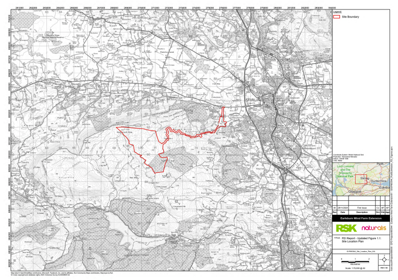
Additional Information - Updated Figure 1.1 Site Location Plan
Additional Information - Updated Figure 1.2 Application Boundary
Additional Information - Updated Figure 1.3 Site Aerial Context
Additional Information - Updated Figure 3.1 Environmental Considerations
Additional Information - New Figure 3.4 Design Iteration from EIAR to FEI
Additional Information - Updated Figure 4.1 Site Layout Plan
Additional Information - Updated Figure 4.2 Indicative Turbine Elevation
Additional Information - Updated Figure 4.4 Indicative Turbine Foundation
Additional Information - Updated Figure 4.5 Indicative Crane Hardstanding
Additional Information - Updated Figure 4.11 Indicative Battery Energy Storage Facility
06 Landscape and Visual
Additional Information - New Figure 6.1 Bareground Zone of Theoretical Visibility
Additional Information - New Figure 6.2 Zone of Theoretical Visibility including Woodland and Settlement
Additional Information - New Figure 6.3 Comparative Zone of Theoretical Visibility
Additional Information - New Figure 6.4 Topography and Landcover
Additional Information - New Figure 6.5 Landscape Character
Additional Information - New Figure 6.6 Landscape Character with Visibility
Additional Information - New Figure 6.7 Visual Receptors
Additional Information - New Figure 6.8 Cumulative Developments
Additional Information - New Figure 6.9 Cumulative Zone of Theoretical Visibility Operational and Consented
Additional Information - New Figure 6.10 Cumulative Zone of Theoretical Visibility Wind Farms in Planning
07 Ecology
Additional Information - Updated Figure 7.1 Ecological Survey Areas
Additional Information - Updated Figure 7.2 Natural Heritage Designated Sites
Additional Information - Updated Figure 7.3a Phase 1 Habitats - Site Access
Additional Information - Updated Figure 7.3b Phase 1 Habitats - Site
Additional Information - Updated Figure 7.4a National Vegetation Classification - Site Access
Additional Information - Updated Figure 7.4b National Vegetation Classification - Site Access
Additional Information - Updated Figure 7.4c National Vegetation Classification - Site Access
Additional Information - Updated Figure 7.4d National Vegetation Classification - Site Access
Additional Information - Updated Figure 7.4e National Vegetation Classification - Site Access
Additional Information - Updated Figure 7.4f National Vegetation Classification - Site
Additional Information - Updated Figure 7.4g National Vegetation Classification - Site
Additional Information - Updated Figure 7.5a Protected Species Survey Results - Site Access
Additional Information - Updated Figure 7.5b Protected Species Survey Results - Site
Additional Information - Updated Figure 7.6 Bat Activity Survey Results
Additional Information - Updated Figure 7.7 Indicative Habitat Enhancement Areas
08 Ornithology
Additional Information - Updated Figure 8.1a Ornithological Survey Areas - Proposed Development
Additional Information - Updated Figure 8.1b Ornithological Survey Areas - Adjacent Wind Farms
Additional Information - Updated Figure 8.2 Relevant Designated Sites
Additional Information - Updated Figure 8.3 Breeding Bird Survey Results - Waders
Additional Information - Updated Figure 8.4a Flight Activity by Target Species (Sep 2020 to Mar 2021)
Additional Information - Updated Figure 8.4b Flight Activity by Target Species (Apr to Aug 2021)
Additional Information - Updated Figure 8.4c Flight Activity by Target Species (Sep 2021 to Mar 2022)
Additional Information - Updated Figure 8.4d Flight Activity by Target Species (Apr to Aug 2022)
Additional Information - Updated Figure 8.5a Index of Red Kite Flight Activity (Sep 2020 to Mar 2021)
Additional Information - Updated Figure 8.5b Index of Red Kite Flight Activity (Apr to Aug 2021)
Additional Information - Updated Figure 8.5c Index of Red Kite Flight Activity (Sep 2021 to Mar 2022)
Additional Information - Updated Figure 8.5d Index of Red Kite Flight Activity (Apr to Aug 2022)
Additional Information - New Figure 8.6 Flight Activity by Target Species (Oct 2024 to Dec 2024)
09 Geology, Hydrogeology, Hydrology and Peat
Additional Information - Updated Figure 9.3 Peat Depth
11 Traffic and Transport
Additional Information - Updated Figure 11.4 Peak Construction Trip Generation
Additional Information - New Figure 11.5 Non-abnormal Load Construction Traffic Route
12 Noise
14 Socio-economics
Additional Information - Updated Figure 14.1 Socio-economic receptors
Volume 3b - Landscape and Visual Impact Assessment Visualisations
Additional Information - Volume 3b - Landscape and Visual Impact Assessment Visualisations - Cover Pages - Clarification
Additional Information - Landscape and Visual Impact Assessment Visualisations
Volume 3c - Cultural Heritage Visualisations
Additional Information - Volume 3c, Cultural Heritage Visualisations
Volume 4 - Technical Appendices
01-05 Introductory Chapters
06 Landscape and Visual
Additional Information - New Technical Appendix 6.1 Methodology
Additional Information - New Technical Appendix 6.3a Landscape Sensitivity - LCT1
Additional Information - New Technical Appendix 6.5 A811 & A873 Wirelines
Additional Information - New Technical Appendix 6.6 Illustrative Views
Additional Information - New Technical Appendix 6.7 Effects less than Moderate
Additional Information - New Technical Appendix 6.9 Residential Visual Amenity Assessment
Additional Information - New Technical Appendix 6.10 Comparison of Effects with EIAR
07 Ecology
08 Ornithology
FEI Report - Updated Figure 8.2 Bird Collision Risk Model Results
09 Hydrology
Figures supporting TA's
FEI Report - Updated Figure 9.1.1 Slope Mapping
FEI Report - Updated Figure 9.1.2 Geomorphological Mapping
FEI Report - Updated Figure 9.1.3a Peat Depth Overview
FEI Report - Updated Figure 9.1.3b Peat Depth Detail - Map 1 of 9
FEI Report - Updated Figure 9.1.3b Peat Depth Detail - Map 2 of 9
FEI Report - Updated Figure 9.1.3b Peat Depth Detail - Map 3 of 9
FEI Report - Updated Figure 9.1.3b Peat Depth Detail - Map 4 of 9
FEI Report - Updated Figure 9.1.3b Peat Depth Detail - Map 5 of 9
FEI Report - Updated Figure 9.1.3b Peat Depth Detail - Map 6 of 9
FEI Report - Updated Figure 9.1.3b Peat Depth Detail - Map 7 of 9
FEI Report - Updated Figure 9.1.3b Peat Depth Detail - Map 8 of 9
FEI Report - Updated Figure 9.1.3b Peat Depth Detail - Map 9 of 9
FEI Report - Updated Figure 9.1.4 Likelihood Rating
FEI Report - Updated Figure 9.1.5 Consequence Rating
FEI Report - Updated Figure 9.1.6 Risk Rating
FEI Report - Updated Figure 9.4.1 - Potentially Groundwater-Dependent Terrestrial Ecosystems
FEI Report - Updated Figure 9.5.1 Watercourse Crossing Locations
11 Traffic and Transport
Additional Information - Volume 4, New Technical Appendix 11.3 Stage 1 Road Safety Audit
Additional Information - Volume 4, New Technical Appendix 11.4 A811-Touch Road Junction Modelling Report
12 Noise
Additional Information - New Technical Appendix A12.1 Noise Survey and Modelling
15 Other Issues
Additional Information - Updated Technical Appendix 15.1 Carbon Calculator
Original Application (2022)
Section 36 Public Notice [download]
Application Documents
Volume 1 - Non-Technical Summary
Volume 2 - Main Text
Chapter 02: Planning and Energy Policy
Chapter 03: Site Selection and Design Evolution
Chapter 04: Project Description
Chapter 05: Construction, Operation and Decommissioning
Chapter 06: Landscape and Visual Impact Assessment
Chapter 09: Geology, Hydrogeology, Hydrology and Peat
Chapter 10: Cultural Heritage and Archaeology
Chapter 11: Traffic and Transportation
Chapter 12: Noise and Vibration
Chapter 13: Aviation and Radar
Chapter 14: Socia-Economic Impact Assessment
Volume 3a - Figures
Figure 1.1 - Site Location Plan
Figure 1.2 - Application Boundary
Figure 1.3 - Site Aerial Context
Figure 3.1 - Design Iterations
Figure 3.2 - Design Iteration Through the Garden
Figure 3.3 - Environmental Considerations
Figure 4.2 - Indicative Wind Turbine Elevation
Figure 4.3 - Indicative External Transformer
Figure 4.4 - Indicative Turbine Foundation
Figure 4.5 - Indicative Crane Hardstanding
Figure 4.6 - Indicative Construction Compound
Figure 4.7 - Indicative Control Room
Figure 4.8 - Site Access Details
Figure 4.9 - Indicative Track Details
Figure 4.10 - Indicative Cable Trench Details
Figure 4.11 - Indicative Battery Energy Storage
Figure 4.12 - Indicative Switching Station
Figure 4.13a - GDL Crossing - Option C Swept Path Sheet 1
Figure 4.13b - GDL Crossing - Option C Swept Path Sheet 2
Figure 4.13c - GDL Crossing - Option C Swept Path Sheet 3
Figure 6.1 - Zone of Theoretical Visibility (Blade Tip) - Bare Ground
Figure 6.2 - Zone of Theoretical Visibility (Hub Height) - Bare Ground
Figure 6.3 - Zone of Theoretical Visibility with Screening Effect of Woodland and Settlement
Figure 6.4 - Landscape Planning Context
Figure 6.5 - Landscape Character
Figure 6.6 - Landscape Character with ZTV
Figure 6.7 - Topography and Landcover
Figure 6.8 - Recreational Receptors
Figure 6.9 - Cumulative Location Plan
Figure 6.10 - Cumulative ZTV Operational and Consented
Figure 6.11 - Existing Light Environment and Key Receptors
Figure 6.12 - Zone of Theoretical Visibility Aviation Tower Lights
Figure 6.13 - Zone of Theoretical Visibility Aviation Hub Lights
Figure 7.1 - Ecological Survey Areas
Figure 7.2 - Natural Heritage Designated Sites
Figure 7.3a - Phase 1 Habitats - Site Access
Figure 7.3b - Phase 1 Habitats - Site
Figure 7.4a - National Vegetation Classification - Site Access
Figure 7.4b - National Vegetation Classification - Site Access
Figure 7.4c - National Vegetation Classification - Site Access
Figure 7.4d - National Vegetation Classification - Site Access
Figure 7.4e - National Vegetation Classification - Site
Figure 7.4f - National Vegetation Classification - Site
Figure 7.4g - National Vegetation Classification - Site
Figure 7.5a - Protected Species Survey Results - Site Access
Figure 7.5b - Protected Species Survey Results - Site
Figure 7.6 - Bat Activity Survey Results
Figure 7.7 - Indicative Habitat Enhancement Areas
Figure 8.1a - Ornithological Survey Areas (Proposed Development)
Figure 8.1b - Ornithological Survey Areas (Adjacent Wind Farms)
Figure 8.2 - Relevant Designated Sites
Figure 8.3 - Breeding Bird Survey Results - Waders 2021-22
Figure 8.4a - Flight Activity by Target Species (Sep 2020 to Mar 2021)
Figure 8.4b - Flight Activity by Target Species (Apr to Aug 2021)
Figure 8.4c - Flight Activity by Target Species (Sep 2021 to Mar 2022)
Figure 8.4d - Flight Activity by Target Species (Apr to Aug 2022)
Figure 8.5a - Index of Red Kite Flight Activity (Sep 2020 to Mar 2021)
Figure 8.5b - Index of Red Kite Flight Activity (Apr to Aug 2021)
Figure 8.5c - Index of Red Kite Flight Activity (Sep 2021 to Mar 2022)
Figure 8.5d - Index of Red Kite Flight Activity (Apr to Aug 2022)
Figure 9.1b - Superficial Geology
Figure 9.4 - Hydrological Catchments
Figure 9.5 - Private Water Supplies
Figure 10.1 - Cultural Heritage Assets in the Inner Study Area
Figure 10.2 - Cultural Heritage Assets in the Outer Study Area
Figure 11.1 - Traffic Study Area
Figure 11.2 - Traffic Count Points
Figure 11.3 - Traffic Accident Data
Figure 11.4 - Construction Trip Generation
Figure 13.1 - Visual Flight Rules 250k Chart Extract
Figure 14.1 - Socio-Economic Tourism and Recreation Receptors Local
Figure 15.1 - Wind Farm Felling Areas
Figure 15.2 - Existing Forestry Breaks
Volume 3b – LVIA VPS and cover, contents page
Illustrative Viewpoint A - Flanders Moss
Illustrative Viewpoint B - B9124 West of Cowe
Illustrative Viewpoint C - Conic Hill
Illustrative Viewpoint D - Ben Ledi
Illustrative Viewpoint E - Touch Road
Volume 3c – CHVPs and cover, contents page
Volume 4 - Technical Appendices
Volume 4 - 5.1 - Schedule of Environmental Commitments
Volume 4 - 6.3 - Landscape Sensitivity
Volume 4 - 6.4 - Viewpoint Analysis
Volume 4 - 6.5 - Sequential Wirelines – A811 & A873
Volume 4 - 6.6 - Shelloch VP12
Volume 4 - 6.7 - Effects Less than Moderate
Volume 4 - 6.9 - Residential Visual Amenity Assessment
Volume 4 - 7.1 - Ecological Desk Study and Survey Results
Volume 4 - 7.2 - Outline Species Protection Plans
Volume 4 - 8.1 - Ornithological Desk Study and Survey Report
Volume 4 - 8.2 - Collision Risk Modelling Report
Volume 4 - 8.3 - Outline Bird Protection Plan
Volume 4 - 9.1 - Peat Slide Risk Assessment
Volume 4 - 9.2 - Outline Peat Management Plan
Volume 4 - 9.3 - Borrow Pit Assessment
Volume 4 - 9.4 - Groundwater Dependent Terrestrial Ecosystem Assessment
Volume 4 - 9.5 - Drainage Impact and Watercourse Crossing Assessment
Volume 4 - 10.1 - Cultural Heritage Baseline S1 Settings Assessment
Volume 4 - 11.1 - Abnormal Route Load Assessment
Volume 4 - 11.2 - Construction Traffic Management Plan
Volume 4 - 13.1 - Aviation Lighting Assessment